| Version 11 (modified by , 4 years ago) ( diff ) |
|---|
Node s2-lg1 is the second sector of Large Node 1, located on the 18th floor roof of the Mudd Building at Columbia University, roughly 68m above the campus level and 78m above the street level. Sector 2's antenna is pointed to the northwest overlooking the intersection of Broadway and 120th St, and Manhattanville, West Harlem.
Contributors: Gulnur Avci, Sienna Brent, Sabbir Hossain, Jared Moser, Watson Mushimbei, Doris Qian, Irfan Tamim, Manav Kohli
Data: Available here (CSV)
Node photographs
Figure 1: Photographs of s2-lg1
Looking down from Mudd building rooftop. s2-lg1 antenna on the far left.
Coverage
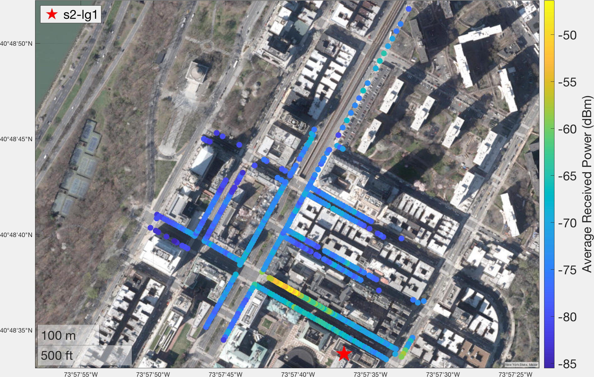
Coverage measurements were performed around the campus area in June-August 2021. In total, 457 measurements were taken in the streets around the large node. The measurement results are presented below.
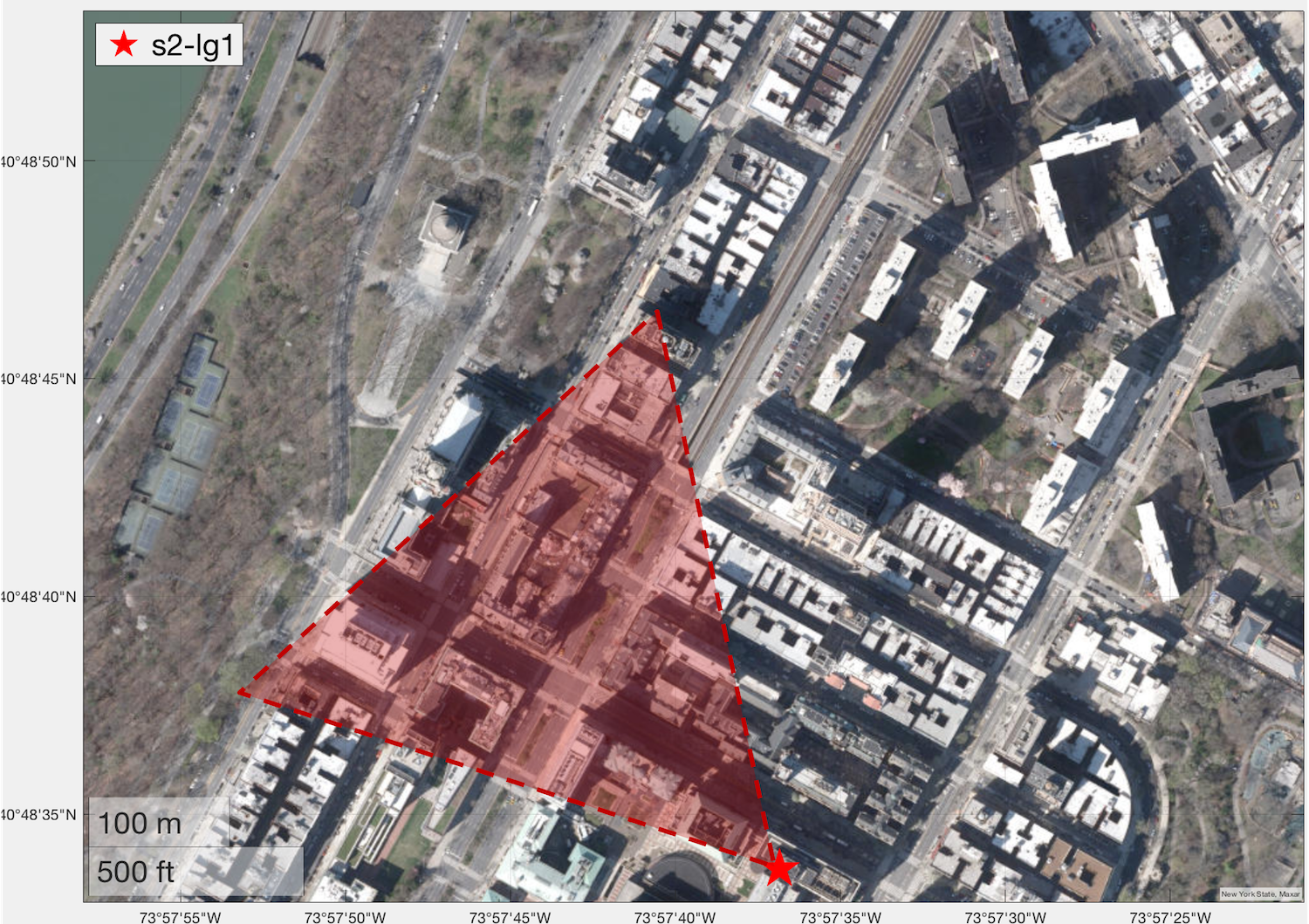
Figure 2: Coverage measurement results for s2-lg1.

(a) Measurement results (b) 60 degree 3dB antenna beamwidth displayed over measurement map
The measurements show -77 dBm RSSI at a link distance up to 550m distance away. The location with highest signal strength received was on 120th St within the 3dB beam width of the antenna. These measurements demonstrate that s2-lg1 provides coverage to a significant portion of Broadway almost up to 125th St, along with streets between Broadway and Amsterdam Ave. Coverage also extends to Riverside Park and portions of Claremont Ave.
Attachments (4)
- s2-lg1_roof.jpg (4.1 MB ) - added by 4 years ago.
- s2-lg1_antenna_coverage.png (2.7 MB ) - added by 4 years ago.
- rssi_coverage_map_s2-lg1.png (2.8 MB ) - added by 4 years ago.
- rssi_coverage_map_s2-lg1.csv (28.9 KB ) - added by 3 years ago.
