| Version 19 (modified by , 4 years ago) ( diff ) |
|---|
Node s3-lg1 is the third sector of Large Node 1, located on the 18th floor roof of the Mudd Building at Columbia University, roughly 50m above the campus level and 60m above the street level. Unlike sectors 1 and 2, sector 3's antenna is pointed to the west overlooking the Columbia Morningside Heights campus.
Contributors: Gulnur Avci, Sienna Brent, Angel Daniel Estigarribia, Sabbir Hossain Leoni Lu, Jared Moser, Dwiref Oza, Irfan Tamim, Jeswanth Yadagani
Data: Available here (CSV)
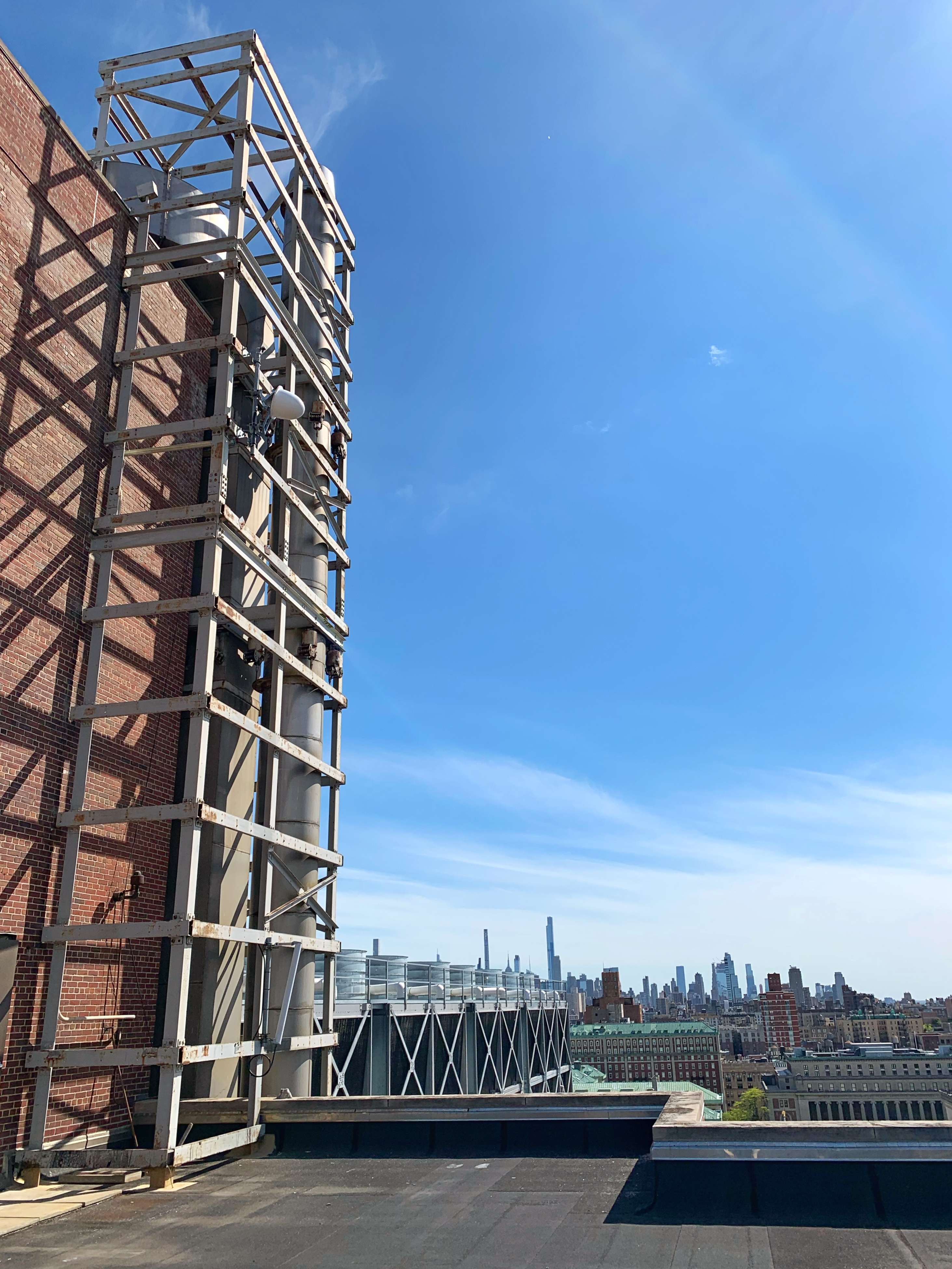
Node photographs
Figure 1: Photographs of s3-lg1 

(a) Looking up from campus level (b) From Mudd building rooftop
Coverage
Coverage measurements were performed around the campus area in August 2020. Subsequent measurements were performed in May 2021 to both corroborate the measurements from August 2020 as well as extend the measurement area. In total, 352 measurements were taken in a roughly 5m-spaced grid in the campus and Broadway areas. The measurement results are presented below.
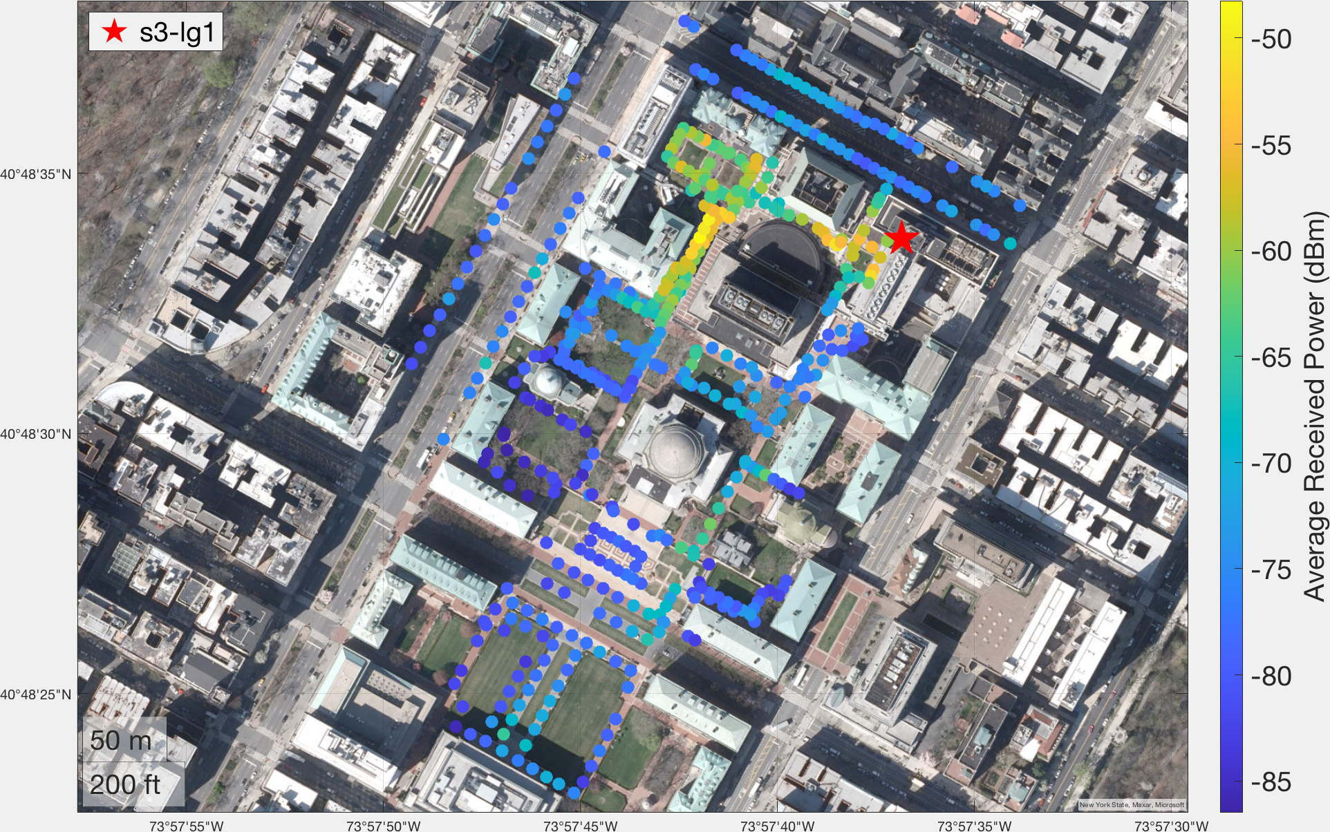
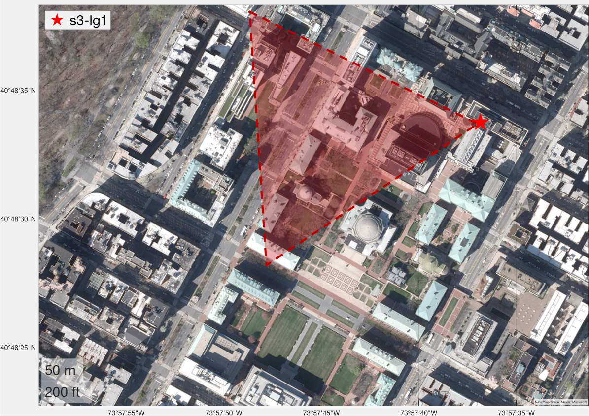
Figure 2: Coverage measurement results for s3-lg1.

(a) Measurement results (b) 60 degree 3dB antenna beamwidth displayed over campus map
These measurements demonstrate an RSSI of around -85 dBm at a 300m straight-line distance, even in the presence of multiple buildings blocking line of sight. As would be expected, the locations close to the node and within the 3dB beamwidth experience higher RSSI.
Of particular note are the measurements in the eastern area of the campus. This area is not only shadowed by several buildings, but is also outside of the beamwidth of s3-lg1's antenna. This demonstrates that s3-lg1 provides coverage for a significant area of the Columbia campus, making it useful for experiments undertaken in this area.
To-Do
Further measurements around Butler Library in the southern area of the campus.
Attachments (5)
- s3-lg1_campus.jpg (844.3 KB ) - added by 5 years ago.
- s3-lg1_roof.jpg (3.3 MB ) - added by 5 years ago.
- columbia_campus_antenna_coverage.png (2.0 MB ) - added by 5 years ago.
- rssi_coverage_map_s3-lg1.png (3.3 MB ) - added by 4 years ago.
- rssi_coverage_map_s3-lg1.csv (29.9 KB ) - added by 4 years ago.
