| Version 31 (modified by , 5 years ago) ( diff ) |
|---|
Site Navigation
- COSMOS Testbed Overview
- Getting Started
- COSMOS/ORBIT User Guide
- COSMOS Portal
- Account Management
- Portal Dashboard
- Directory
- Disk Images
- Community Forum
- Getting Started with the COSMOS Portal
- SSH Access to Testbed Nodes
- Scheduler
- Testbed Status
- Installing Chrome Remote Desktop (CRD) on a Custom Image
- Tutorials
- Architecture
- Resources, Services and APIs
- Datasets
- Hardware Info
- RF Policies & Compliance
Deployment Map
Current Outdoor Sites
Map locations and GPS coordinates are only approximate and for rough reference only.
| Abbreviation | Site | Description | Location | Measurement |
|---|---|---|---|---|
| co1 | core 1 | CU CS Building CRF compute | map | |
| co2 | core 2 | Datacenter at 32 Avenue of the Americas | map | |
| lg1 | large 1 | CU Mudd building 18th floor rooftop | map | s2-lg1, s3-lg1 |
| md1 | medium 1 | CU Mudd building 1st floor (120th Street) | map | |
| md2 | medium 2 | CU Mudd building 2nd floor (Amsterdam Ave) | map | md2 |
CU = Columbia University
Coverage measurements of the outdoor nodes when transmitting 802.11g WiFi data packets at 2.412 GHz are described here.
Current and upcoming sites
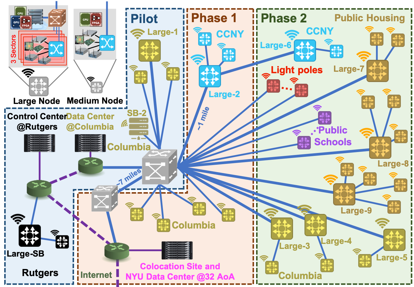
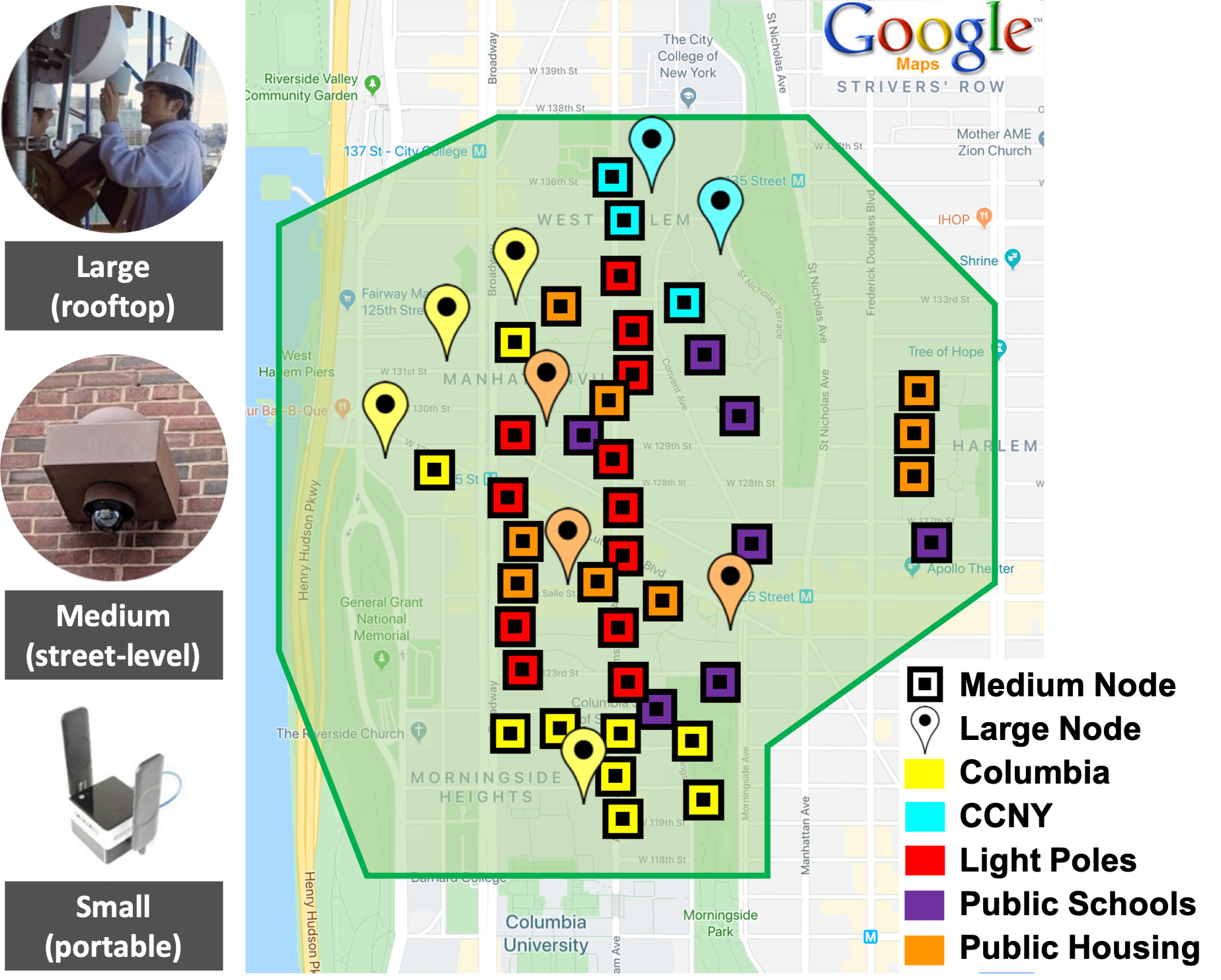
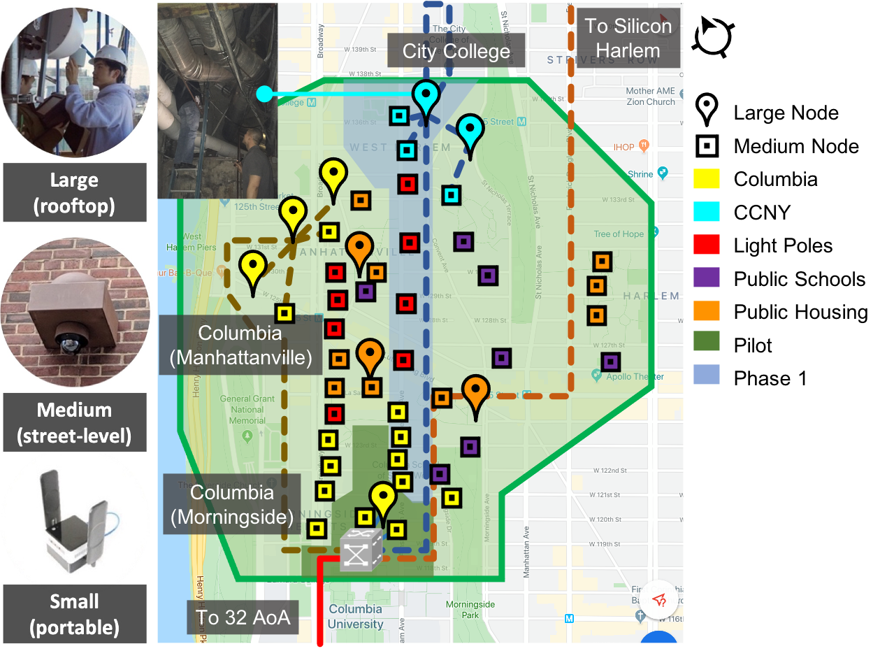
The figure below shows COSMOS’ envisioned deployment area of about 1 sq. mile covering about 15 city blocks and about 5 city avenues, with tentative deployment sites marked on the map.

The pilot phase in the figure below (which includes the sites above) was completed in May 2019. Phase 1 completion date was planed for the end of 2020 but now depends on NYC and NYS re-opening following COVID-19. The full envisioned deployment is illustrated in Phase 2.

Attachments (4)
- COSMOS_phases_20190822.jpg (1.2 MB ) - added by 6 years ago.
- COSMOS_deployment_map_20190822.jpg (1.3 MB ) - added by 6 years ago.
- COSMOS_deployment_map_20200923.png (735.4 KB ) - added by 5 years ago.
- COSMOS_phases_20220322.jpg (215.3 KB ) - added by 4 years ago.
Note:
See TracWiki
for help on using the wiki.